World Heritage Identification Number: 1153
World Heritage since: 2011
Category: Cultural Heritage
WHE Type: Agriculture Landscapes, Parks & Gardens
Transboundary Heritage: No
Endangered Heritage: No
Country: 🇫🇷 France
Continent: Europe
UNESCO World Region: Europe and North America
Map
The Causses and the Cévennes, Mediterranean Agro-Pastoral Cultural Landscape: A Millennia-Old Relationship Between Man and Nature
The Causses and the Cévennes, Mediterranean Agro-Pastoral Cultural Landscape is a remarkable testament to the longstanding symbiotic relationship between humans and their natural environment. Inscribed as a UNESCO World Heritage Site in 2011, this expansive region spanning over 302,319 hectares in central France offers a unique insight into the intricate balance between agriculture, livestock rearing, and the physical landscape.
More to come…UNESCO Description of the World Heritage Site
This 302,319 ha property, in the southern part of central France, is a mountain landscape interspersed by deep valleys that is representative of the relationship between agro-pastoral systems and their biophysical environment, notably through drailles or drove roads. Villages and substantial stone farmhouses on deep terraces of the Causses reflect the organization of large abbeys from the 11th century. Mont Lozère, inside the property, is one of the last places where summer transhumance is still practiced in the traditional way, using the drailles.
UNESCO Justification of the World Heritage Site
Criterion (iii): The Causses and the Cévennes, manifest an outstanding example of one type of Mediterranean agro-pastoralism. This cultural tradition, based on distinctive socialstructures and local breeds of sheep, is reflected in the structure of the landscape, especially the patterns of farms, settlements, fields, water management, drailles and open grazed common land and what it reveals of the way this has evolved, in particular since the 12th century.The agro-pastoral tradition is still living and has been revitalisedin recent decades.
Criterion (v): The Causses and the Cévennes can be seen as an exemplar of Mediterranean agropastoralism and specifically to represent a response common to the south-west of Europe. The landscape areas manifest exceptional responses to the way the system has developed over time and particularly over the past millennia.
Encyclopedia Record: Causses and Cévennes
The Causses and the Cévennes, Mediterranean agro-pastoral Cultural Landscape is a UNESCO World Heritage Site located in the southern part of central France with over three millennia of agro-pastoral history.Additional Site Details
Area: 302,319 hectares
Number of Components: 1
(v) — Outstanding example of traditional human settlement
Coordinates: 44.2202777778 , 3.4730555556
Image
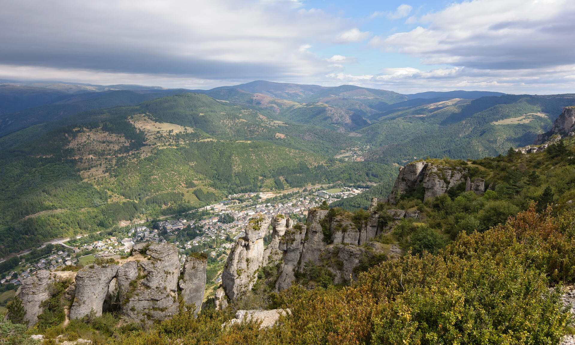
© Myrabella, CC BY-SA 3.0 Resized from original. (This derivative is under the same CC BY-SA license.)
World Heritage Research
Discover scientific research and academic studies that deepen our understanding of The Causses and the Cévennes, Mediterranean agro-pastoral Cultural Landscape from its history and significance to its conservation, management, and contemporary challenges.
-
Assessing the Impact of Climate Change on the Landscape Stability in the Mediterranean World Heritage Site Based on Multi-Sourced Remote Sensing Data: A Case Study of the Causses and Cévennes, France
Climate change is significantly destabilizing the Causses and Cévennes, a UNESCO World Heritage Site in France. A study using multi-sourced remote sensing data from 1985 to 2020 revealed that this Mediterranean agro-pastoral landscape experienced warming and drying trends, leading to a decline in woodland coverage (from 76% to 66.5%), increased fragmentation, and shifts among land cover types like cropland, shrubland, and grasslands. Landscape stability showed marked spatiotemporal variations with an overall downward trend. Precipitation emerged as the dominant climatic factor influencing landscape stability, particularly through its interaction with temperature. These findings highlight vulnerabilities in Mediterranean heritage sites, offering critical insights for sustainable conservation strategies.
Zhu, M., Zhu, D., Huang, M., Gong, D., Li, S., Xia, Y., Lin, H., & Altan, O. (2025). Assessing the Impact of Climate Change on the Landscape Stability in the Mediterranean World Heritage Site Based on Multi-Sourced Remote Sensing Data: A Case Study of the Causses and Cévennes, France. Remote Sensing, 17(2), 203. https://doi.org/10.3390/rs17020203
View Publication Record | Read Publication -
Geometry and tectonic history of the Northeastern Cévennes Fault System (Southeast Basin, France) : new insights from deep seismic reflection profiles
A new deep seismic reflection survey of the Northeastern Cévennes Fault System (NCFS) reveals its polyphase tectonic history, spanning 320 million years. The study identifies three major phases: initial normal faulting during the Lower Jurassic and Lower Cretaceous, reactivation as a transfer fault zone during Pyrenean shortening in the Upper Cretaceous, and subsequent Oligocene extension. These findings update the geological history of the Vivaro-Cévenol region and constrain structures affecting the Southeast Basin since the Mesozoic. The research provides critical insights for paleoseismological studies following the 2019 Le Teil earthquake (Mw4.9), aiding seismic hazard assessment in the region.
Thomasset, C., Ritz, J.-F., Pouliquen, S., Manchuel, K., & Le-Roux-Mallouf, R. (2024). Geometry and tectonic history of the Northeastern Cévennes Fault System (Southeast Basin, France) : new insights from deep seismic reflection profiles. BSGF - Earth Sciences Bulletin, 195, 17. https://doi.org/10.1051/bsgf/2024016
View Publication Record | Read Publication -
Impact of alteration corridors on karst reservoir organisation and evolution of groundwater flow path: An example from the southern border of the Larzac Causse, southern France
Alteration corridors, vertically elongated structures containing dissolution-collapse breccia, significantly influence the organization and evolution of karst reservoirs by facilitating fluid circulation between upper and lower aquifers that were once separated by a marly seal unit. These corridors, primarily oriented in a N-S direction on the Larzac Causse, enhance regressive erosion dynamics, capturing watersheds like the Vis River and determining the position of present-day pocket valley springs. The study used a 3D approach to correlate field observations with remote sensing, revealing that ghost-rock karstification plays a crucial role in the structure and evolution of the karstic reservoir. Additionally, residual alterites are evacuated during high-flow events, providing insights into connected reservoir volumes and associated flow dynamics. These findings highlight the importance of corridor networks as valuable targets for water exploration when located below the piezometric level.
Baral, C., Séranne, M., Camus, H., & Jouves, J. (2024). Impact of alteration corridors on karst reservoir organisation and evolution of groundwater flow path: An example from the southern border of the Larzac Causse, southern France. BSGF - Earth Sciences Bulletin, 195, 4. https://doi.org/10.1051/bsgf/2023017
View Publication Record | Read Publication -
Evidence for Mississippi Valley-type lead-zinc mineralization in the Cévennes region, Southern France, during Pyrénées orogeny
New paleomagnetic analysis reveals that Mississippi Valley-type (MVT) lead-zinc mineralization in the Cévennes region of southern France occurred during the Lower-Middle Eocene, coinciding with the Pyrénées orogeny. This challenges previous assumptions linking mineralization to Mesozoic continental extension and instead suggests it resulted from large-scale fluid flow associated with tectonic activity. The study combines paleomagnetic data with radiometric (U-Th-Pb) and isotopic (Sm-Nd) analyses of ore-stage fluorite, providing robust evidence for the timing and origin of these deposits.
Leach, D., Premo, W., Lewchuk, M., Henry, B., Le Goff, M., Rouvier, H., Macquar, J.-C., & Thibiéroz, J. (2022). Evidence for Mississippi Valley-type lead-zinc mineralization in the Cévennes region, Southern France, during Pyrénées orogeny. Mineral Deposits at the Beginning of the 21st Century, 157–160. https://doi.org/10.1201/9781003077503-39
View Publication Record | Read Publication -
Konservat-Lagerstätten from the Upper Jurassic lithographic limestone of the Causse Méjean (Lozère, southern France): palaeontological and palaeoenvironmental synthesis
The Upper Jurassic lithographic limestone of the Causse Méjean, France, has been identified as a significant Konservat-Lagerstätte, preserving exquisite fossils that offer unprecedented insights into Kimmeridgian–Tithonian coastal and lagoonal ecosystems. This study, spanning two decades of prospection, reveals a diverse fossil assemblage comprising marine organisms—such as algae, ammonites, belemnites, and a coelacanth—as well as terrestrial flora and fauna, including conifers and a rhynchocephalian. Ichnofossils, including limulid trackways and coprolites, further enrich the palaeoenvironmental record. The exceptional preservation of these fossils suggests a calm, shallow-marine setting, likely a lagoon occasionally connected to the sea. This research underscores the Causse Méjean's importance as a key site for understanding Upper Jurassic palaeobiodiversity and palaeoecology, comparable to other renowned European plattenkalks like Solnhofen.
Moreau, J.-D., Vullo, R., Charbonnier, S., Jattiot, R., Trincal, V., Néraudeau, D., Fara, E., Baret, L., Garassino, A., Gand, G., & Lafaurie, G. (2022). Konservat-Lagerstätten from the Upper Jurassic lithographic limestone of the Causse Méjean (Lozère, southern France): palaeontological and palaeoenvironmental synthesis. Geological Magazine, 159(5), 761–781. https://doi.org/10.1017/s0016756821001382
View Publication Record | Read Publication -
Paleoseismological investigations of the La Rouvière fault, unexpected source of the 11-11-2019, Mw 4.9 Le Teil surface rupturing earthquake (Cévennes fault system, France)
A 2019 earthquake (Mw 4.9) in the Cévennes region of France revealed unexpected surface ruptures linked to the La Rouvière fault, part of the broader Cévennes fault system. Paleoseismological investigations, documented during the 2022 INQUA PATA Days, identified previously unrecognized fault activity in this Mediterranean agro-pastoral landscape. The study highlights the significance of such faults as seismic hazards in regions with low to moderate earthquake risk. By analyzing surface ruptures and geological evidence, researchers provided critical insights into the fault's behavior, contributing to better understanding of seismic risks in UNESCO World Heritage Sites.
Ritz, J.-F. (2022). Paleoseismological investigations of the La Rouvière fault, unexpected source of the 11-11-2019, Mw 4.9 Le Teil surface rupturing earthquake (Cévennes fault system, France). Zenodo. https://doi.org/10.5281/ZENODO.7109757
View Publication Record | Read Publication -
How sensitive are intraplate inherited structures? Insight from the Cévennes Fault System (Languedoc, SE France)
A recent study challenges the notion that deformation within intraplate regions, such as the Cévennes Fault System (CFS) in Languedoc, SE France, is solely a consequence of tectonic events at plate boundaries. By combining U–Pb geochronology of fault-related calcites with structural analysis, researchers found continuous compressional activity along the CFS and its satellite structures from the Albian period through the Eocene, including during periods traditionally considered tectonically quiescent. This indicates that intraplate fault systems can experience low-intensity but regional deformation continuously over time, not just during high-rate plate boundary events. The study also highlights the significance of inherited structures in accommodating far-field deformation, as demonstrated by the recent Le Teil earthquake (Mw = 4.9) along the CFS.
Parizot, O., Missenard, Y., Barbarand, J., Blaise, T., Benedicto, A., Haurine, F., & Sarda, P. (2022). How sensitive are intraplate inherited structures? Insight from the Cévennes Fault System (Languedoc, SE France). Geological Magazine, 159(11-12), 2082–2094. https://doi.org/10.1017/s0016756822000152
View Publication Record | Read Publication