World Heritage Identification Number: 460
World Heritage since: 1988
Category: Cultural Heritage
WHE Type: Infrastructure & Industry
Transboundary Heritage: No
Endangered Heritage: No
Country: 🇨🇺 Cuba
Continent: Americas
UNESCO World Region: Latin America and the Caribbean
Map
Trinidad and the Valley de los Ingenios: A Legacy of Sugar Trade and Colonial Architecture
Trinidad and the Valley de los Ingenios, located in central Cuba, offer a unique blend of history, culture, and natural beauty. This UNESCO World Heritage Site, inscribed in 1988, encompasses the colonial city of Trinidad and the surrounding Valley de los Ingenios, a once thriving center for sugar production.
More to come…UNESCO Description of the World Heritage Site
Founded in the early 16th century in honour of the Holy Trinity, the city was a bridgehead for the conquest of the American continent. Its 18th- and 19th-century buildings, such as the Palacio Brunet and the Palacio Cantero, were built in its days of prosperity from the sugar trade.
UNESCO Justification of the World Heritage Site
Criterion (iv) : Shaped by the region’s 18th- and 19th-century sugar industry, the exemplary city of Trinidad owes to sugar its continued existence and its historical raison d’être, which is clearly legible in the existing built environment of the city and the nearby Valley de los Ingenios.
Criterion (v): The Valley de los Ingenios is a remarkable testimony to the development of the sugar industry and a living museum featuring 75 former sugar mills, plantation houses, barracks and other facilities related to this vulnerable industry.
Encyclopedia Record: Valle de los Ingenios
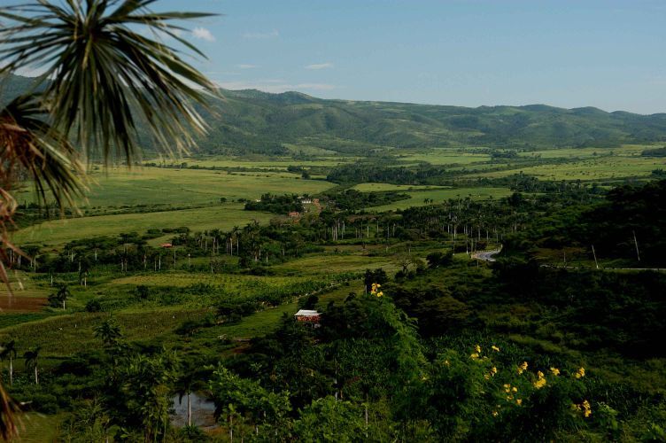
Valle de los Ingenios, also named Valley de los Ingenios or Valley of the Sugar Mills, is a series of three interconnected valleys about 12 kilometres (7.5 mi) outside of Trinidad, Cuba. The three valleys, San Luis, Santa Rosa, and Meyer, were a centre for sugar production from the late 18th century until the late 19th century. At the peak of the industry in Cuba there were over fifty sugar cane mills in operation in the three valleys, with over 30,000 slaves working in the mills and on the sugar cane plantations that surrounded them.Additional Site Details
Area: Not available
Number of Components: 2
(v) — Outstanding example of traditional human settlement
Coordinates: 21.80305556 , -79.98444444
Image
© Vgenecr at Dutch Wikipedia, CC BY-SA 3.0 Resized from original. (This derivative is under the same CC BY-SA license.)
