World Heritage Identification Number: 555
World Heritage since: 1993
Category: Cultural Heritage
WHE Type: Archaeological Sites
Transboundary Heritage: No
Endangered Heritage: No
Country: 🇸🇪 Sweden
Continent: Europe
UNESCO World Region: Europe and North America
Map
Birka and Hovgården: A Viking Age Archaeological Complex
The Birka and Hovgården sites, inscribed as a UNESCO World Heritage Site in 1993, offer a unique insight into the Viking Age trading networks that shaped the history of Scandinavia. Located on two islands in Lake Mälar, these sites are situated approximately 30 kilometers west of modern-day Stockholm, within the municipality of Ekerö, Sweden.
More to come…UNESCO Description of the World Heritage Site
The Birka archaeological site is located on Björkö Island in Lake Mälar and was occupied in the 9th and 10th centuries. Hovgården is situated on the neighbouring island of Adelsö. Together, they make up an archaeological complex which illustrates the elaborate trading networks of Viking-Age Europe and their influence on the subsequent history of Scandinavia. Birka was also important as the site of the first Christian congregation in Sweden, founded in 831 by St Ansgar.
UNESCO Justification of the World Heritage Site
Criterion (iii): The Birka and Hovgården complex bears exceptionally well preserved testimony to the wide-ranging trade network established by the Vikings during the two centuries of their phenomenal economic and political expansion.
Criterion (iv): Birka is one of the most complete and undisturbed examples of a Viking trading settlement of the 8th to 10th centuries.
Encyclopedia Record: Birka
Birka, on the island of Björkö in present-day Sweden, was an important Viking Age trading center which handled goods from Scandinavia as well as many parts of Continental Europe and the Orient. Björkö is located in Lake Mälaren, 30 kilometers west of contemporary Stockholm, in the municipality of Ekerö.Additional Site Details
Area: 437.121 hectares
Number of Components: 2
(iv) — Outstanding example of a type of building or landscape
Coordinates: 59.33514 , 17.54264
Image
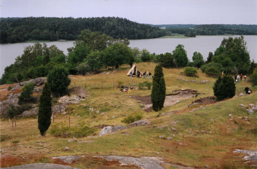
© Alex Peterson, CC BY-SA 3.0 Resized from original. (This derivative is under the same CC BY-SA license.)
World Heritage Research
Discover scientific research and academic studies that deepen our understanding of Birka and Hovgården from its history and significance to its conservation, management, and contemporary challenges.
-
First High‐resolution GPR and Magnetic Archaeological Prospection at the Viking Age Settlement of Birka in Sweden
Ground-penetrating radar (GPR) and magnetic gradiometer surveys at Birka, a UNESCO-listed Viking Age settlement in Sweden, revealed intricate structural details of the proto-urban site. The non-invasive geophysical methods mapped houses, property boundaries, pathways, and buried town ramparts from multiple construction phases, including a gate. This pioneering 2006 study demonstrated the effectiveness of high-resolution GPR and magnetometry for archaeological prospection in Scandinavian contexts, combining state-of-the-art data processing with GIS-based interpretation to uncover new insights about Birka-Hovgården's layout and development.
Trinks, I., Neubauer, W., & Hinterleitner, A. (2014). First High‐resolution GPR and Magnetic Archaeological Prospection at the Viking Age Settlement of Birka in Sweden. Archaeological Prospection, 21(3), 185–199. Portico. https://doi.org/10.1002/arp.1481
View Publication Record | Read Publication -
Efficient, large‐scale archaeological prospection using a true three‐dimensional ground‐penetrating Radar Array system
A ground-penetrating radar (GPR) array system demonstrated the capability to conduct high-resolution, large-scale archaeological surveys at unprecedented speed and resolution. The true three-dimensional MIRA system surveyed 1 hectare or more per day with an 8 cm cross-line spacing, revealing fine details such as postholes of only 25 cm diameter at Birka, a UNESCO World Cultural Heritage site in Sweden. This pilot study, conducted in collaboration with the Swedish National Heritage Board, showcased the potential of advanced GPR technology for efficient and detailed archaeological prospection at complex Scandinavian sites.
Trinks, I., Johansson, B., Gustafsson, J., Emilsson, J., Friborg, J., Gustafsson, C., Nissen, J., & Hinterleitner, A. (2010). Efficient, large‐scale archaeological prospection using a true three‐dimensional ground‐penetrating Radar Array system. Archaeological Prospection, 17(3), 175–186. Portico. https://doi.org/10.1002/arp.381
View Publication Record | Read Publication